


Headley Way and the Great Headley Estate (“The Lakes”)
The Great Headley estate is today nicknamed “The Lakes”, as four of the roads there are named after lakes in the real Lake District in Cumbria, and one after a river there. It is hard to imagine now, but when these roads were first built there was no Headley Way.
Two of the streets are first listed in Kelly's Directory for 1933:
- Ambleside Drive:
North side: just a house called Wayside
South side: the Leavesden Nursing Home and houses called Daymer, Roughway, St Urians, and Marylyn - Bowness Avenue:
East side: Miholme, No. 3, Chez-nous, Ainlee, two unnamed, Dunselnia
West side: Senlac
The other three roads are listed for the first time in Kelly's Directory for 1935:
- Coniston Avenue:
East side: Chaddesley, Glenwood, New Ways, Devonia, Gwyndy, one unnamed, Fairdale, Lynton, one unnamed
West side: Lucerne, Hillview, Peveril, one unnamed, Westcott - Derwent Avenue:
The street appears but with no houses yet - Eden Drive:
East side: Eden House, Headley General Stores, "Here is Ambleside Drive", Tenby, Les Varclins, Thorness, Constant Ridge, Home Close, "Here is Bowness Avenue"
West side: Newsagent & Post Office, Breydon, Attlwalis, Llanelly, "Here is Bowness Avenue".
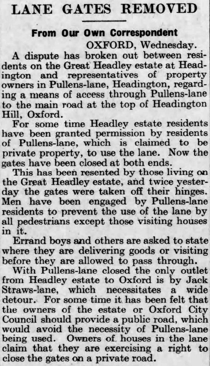
With no Headley Way, the quickest way for the people who lived here on the Great Headley Estate to get to a bus stop was to go up Pullen's Lane, but as this article in the Daily Telegraph on 17 December 1936 shows, the people who lived there wanted to put a stop to this now that the population of the new estate was growing:
Headley Way is first mentioned in Kelly's Directory for 1938 with an early form of numbering that was superseded by the present method in the directory for 1940, which has the following houses:
- South-west side: From city boundary at Copse Lane to Bowness Avenue: Nos. 10 to 70
- West side: From Staunton Road: Nos. 140 back to 122
By 1941 the houses were as follows:
- South-west side: From city boundary at Copse Lane to Bowness Avenue: Nos. 12 to 72
(with the numbers apparently all shifted one on) - West side: From Staunton Road: Nos. 140 back to 122 (as before)
- North-east side: From city boundary at Copse Lane to Bowness Avenue: Nos. 3 to 55
There was now in 1941 a row of shops between Marsh Lane and Copse Lane, whose address is now Cherwell Drive but they were then included under Headley Way. Cherwell Drive does not appear in Kelly's Directory until 1949.
It was not until 1951 that Headley Way was extended south to Woodlands Road, providing pedestrian access via Cuckoo Lane both to Headington and in the other direction to the top of Headington Hill.
Then in 1957 Headley Way was extended south again right up to the point where the Headington Road meets the London Road at the White Horse pub. That pub had to lose its garden to the west and the Boundary Brook was piped underground in order for the road to come through.
The connection to Summertown
On 12 November 1971 the Marston Ferry Road was built to replace the old Marston ferry and also to link Summertown to Cherwell Drive (then still in Headington rather than Marston), and then Headley Way into central Headington.
