


Marston Cycle Track
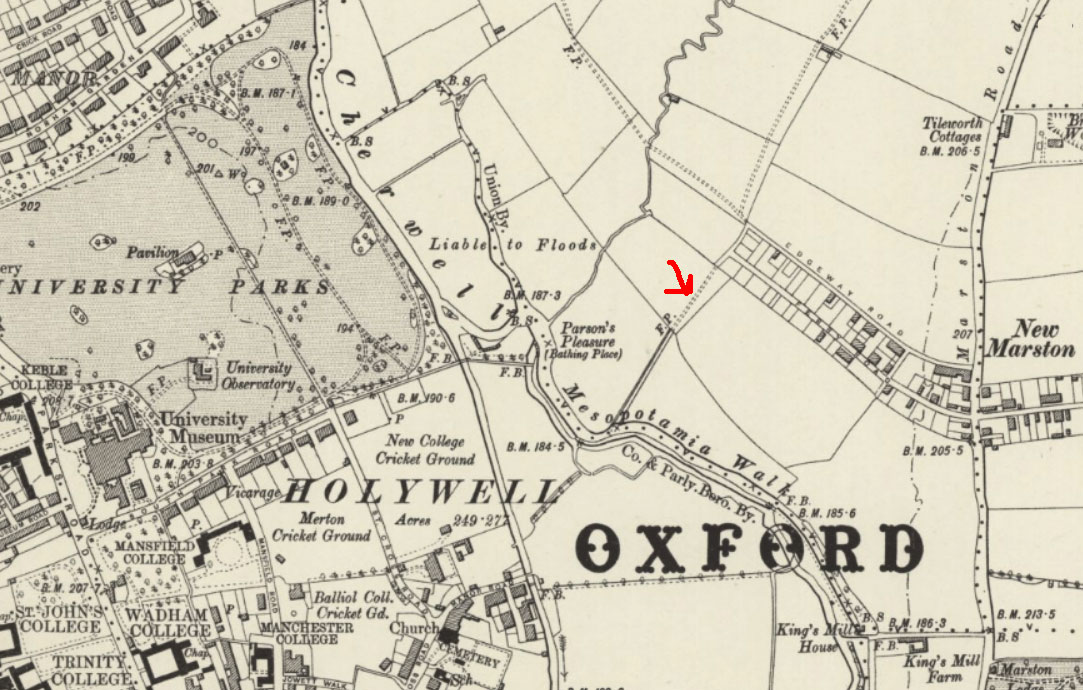
The map below shows New Marston and the University Parks at the end of the nineteenth century. At that time those who lived in Edgeway Road, Ferry Road, and William Street could walk along a footpath (marked with a red arrow) that ran due south-west through fields and continued straight on (just as it does today) to Mesopotamia Walk.
In April 1990 (after thirteen years of discussion), the Hebdomadal Council of the University of Oxford agreed to allow a 24-hour cycle track through to the University Parks, and it was created in 1991. At the same time the bathing place at Parson's Pleasure where men were allowed to bath nude was closed down.
Oxfordshire County Council operates this cycle track on land it holds under a fifty-year peppercorn lease from the University of Oxford and is responsible for its upkeep, including the bridges and the lighting.
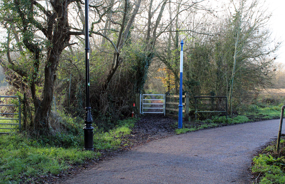
At first the cycle route simply follows the same line as the old footpath to Mesopotamia, but about half-way along a brand new route was cut diagonally right through the fields to the River Cherwell at Parson's Pleasure. The photograph below shows the point at which the newer cycle route splits off from the old pedestrian footpath to the left leading through a gate to Mesopotamia, which (unlike the cycle track) is locked at night:
The article below was published in the Oxford Mail on 21 April 1990:

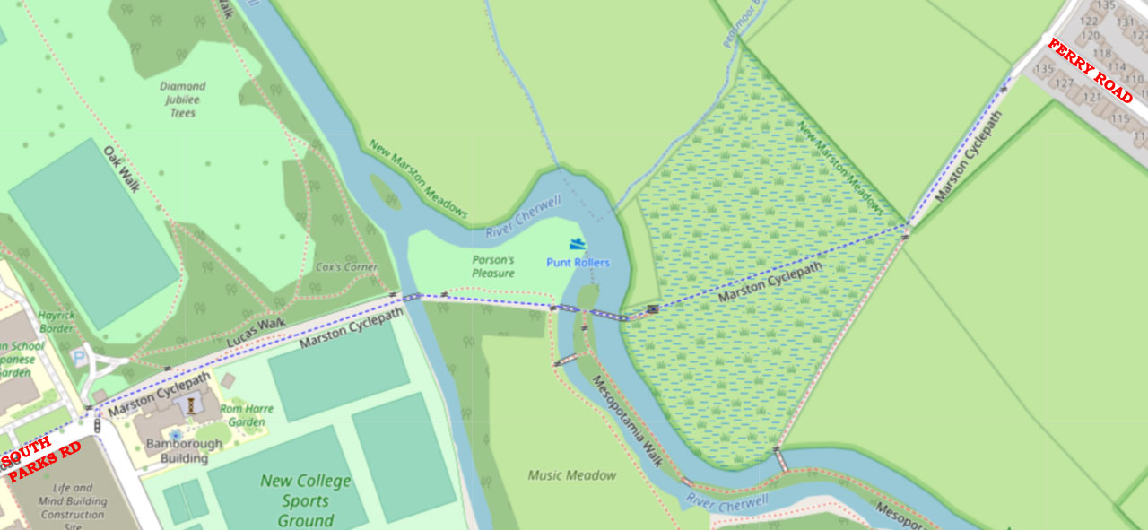
OpenStreetMap today (below) shows the same route as the above drawing:
The track is closed on 25 December and 1 January each year to prevent the route becoming a public right of way. It is also occasionally closed if work has to be done on trees or there is serious flooding.
The three bridges (from the Marston end)
Each of the three bridges crosses a separate branch of the River Cherwell near Parson's Pleasure. This map shows the route of the cycle track and the three bridges.
The two bridges to the east which are very close to each other were renovated in 2023 and were informally named the LeMond and the Fignon bridges after the cyclists Greg LeMond and Laurent Fignon, which is appropriate, as it takes eight seconds to cycle between these two bridges and LeMond beat Fignon by just eight seconds in the Tour de France of 1989.
1. “LeMond” Cycle Bridge

This bridge to the east was built in 1991 especially to carry the new cycle track, and is pictures after renovation in 2023. .
2. “Fignon” Cycle & Pedestrian Bridge
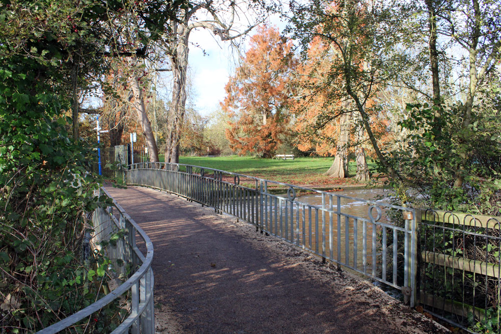
This is the middle of the three bridges and pre-dates the cycle track. It was built in 1949, replacing an earlier timber bridge, and was initially used only by pedestrians.
It was commissioned and funded by the University of Oxford and built of pre-stressed concrete with aluminium alloy parapets. It was designed by R. Travers Morgan & Partners, and the principal contractor was Taylor Woodrow Construction Ltd. It is thought to be the first pre-stressed fixed-arch bridge in the world. Its clear span (the part between structural supports) is 13.7m, and its width is 2.7m.
Since 1998 it has been a Grade II listed structure (List Entry 1119763). The county council had to get Listed Building consent for the work on this bridge in 2023, and the Design, Heritage, & Access Statement under the Documents tab of that planning application (23/00270/LBC) gives very detailed information about it
In 1994 this bridge became part of the Marston Cycle Track and now has shared use.
Photograph of the earlier bridge on this site in 1875 (Historic England CC72/00163):
The third bridge (for both cyclists and pedestrians)
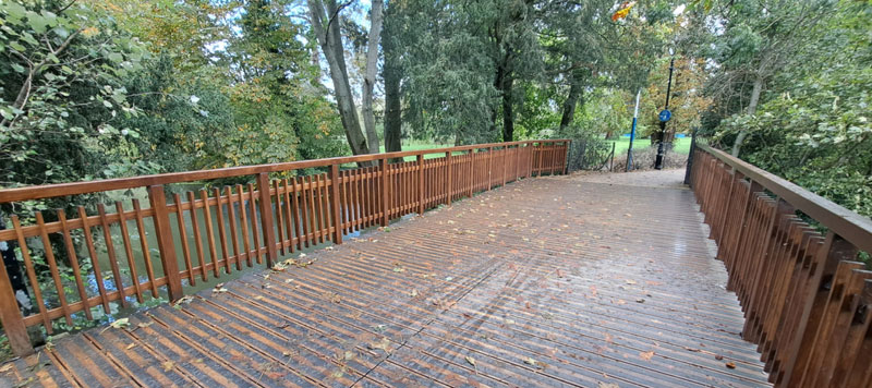 Looking backwards towards Marston
This bridge further to the west near the University Parks does not appear to have a name and is used both by cyclists on the cycle track and pedestrians using Mesopotamia Walk. On the Oxford side of the River Cherwell it joins Holy Walk, an existing path to the south of the University Parks that leads past Linacre College to South Parks Road.
In 1992 planning permission was granted for a new footbridge over the weir at Mesopotamia
(92/00824/NFH)
Temporary closure of cycle track in 2023
In August 2023 the cycle track was closed so that extensive work could be done on both bridges, and it reopened on 14 October 2023, two weeks ahead of schedule. .
The following article by Danny Dorling (Professor of Human Geography at the University of Oxford) was inspired by that closure and how a temporary diversion through the Parks was agreed:
- Danny Dorling, “The souls of the people of Oxford”
Occasional problems on the cycle track


The former Mesopotamia Ferry
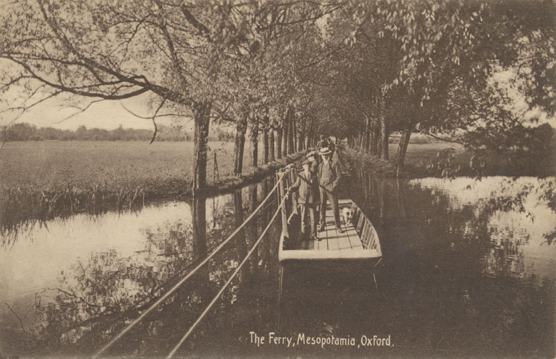
This ferry (after which Ferry Road was named) was about half-way along Mesopotamia Walk and its position is shown in the centre of this map. The ferry-man later lived at Ferry Cottage, which is half-way up Ferry Road (developed in the late 1870s).
The Oxford Journal Illustrated of 10 June 1925 has a photograph of this Mesopotamia Ferry, which was then about to be replaced by a wooden bridge paid for by Mrs E. E. Pope (presumably the widow Ellen Elizabeth Pope, who lived at 60 Banbury Road and died at the age of 80 on 27 June 1933).
See also:
- University Parks website which gives notice of any closures (but not flooding)
- Marston Cycle Path flooding information: a very helpful page created by Ganesh Sittampalam
where you can subscribe for email updates about flooding - Features of the Parks, which includes a section on Bridges and on Mesopotamia
- Parson's Pleasure: more information about the bathing place, which was also known as Loggerhead
